
At the end of March and the beginning of April, we took two side trips south of Perth: one was to Penguin Island and the other was to the Margaret River region. These trips allowed us to view the landscapes, flora, and fauna that make southwest Australia so unique.
This region is a recognized biodiversity hotspot, owing to its extreme isolation. There are many plants and animals here that exist nowhere else on Earth.
Penguin Island
This island is just off the shore of the town of Rockingham (about a 45-minute drive from Perth). To view the island, we took a took a tour that included a visit to the penguin sanctuary on the island, as well as a glass bottom boat ride around the island to view dolphins!
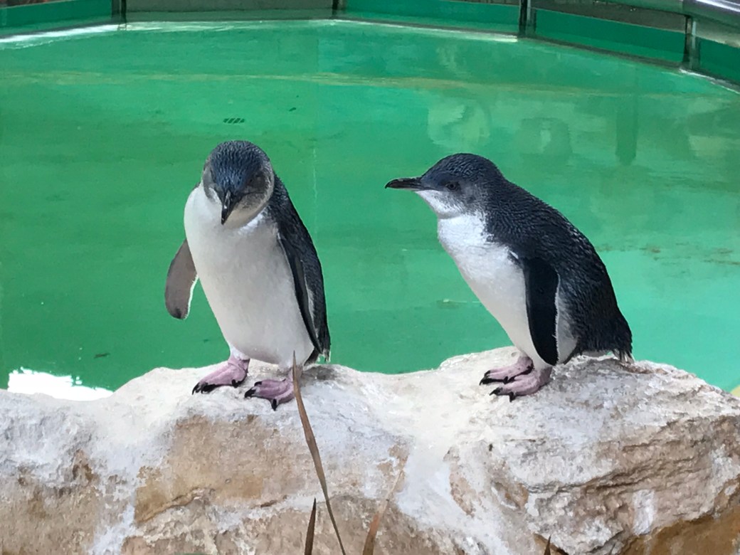
On our glass bottom boat tour around the island, we did not spot any dolphins at first. However, it was fun watching the fish under the boat and observing sea lions and nesting seabirds, including pelicans, on the island. Then, we saw a fin—a dolphin at last! For a while, we enjoyed observing the dolphin from a distance as it alternately dove down for fish and came back up for air.
Then, much to our surprise, the dolphin started swimming toward the boat. It disappeared. To our amazement, we were treated to the sight below (video courtesy of Syd). Our tour guide assured us that this was extremely unusual. With its belly up, the dolphin was clearly checking us out through the glass bottom of the boat!
Busselton
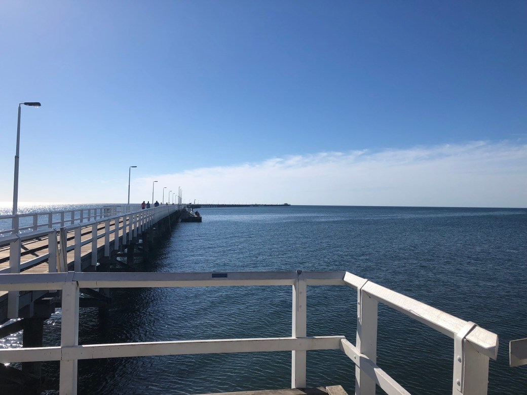
One week later, we traveled even further south for a long weekend to visit the beautiful seaside town of Busselton (our home base for the trip) and the Margaret River region. Busselton is famous for its jetty, which is the longest in the world at two kilometers long! It was built because the harbor at Busselton is extremely shallow, making a long jetty necessary for on- and off-loading the ships that were restricted to deeper waters.
The jetty was going to be destroyed by the government when it fell out of use. However, the people of the town saw its potential to attract visitors, and they were able to save the jetty. Now, the end of the jetty houses an underwater observatory and an “artificial” reef with coral and many types of sea life. This sea life includes tropical species at the southernmost border of their range. You can find tropical species here (and around Rottnest Island) because the Leeuwin ocean current channels warm water to the area.
The reef at the end of the jetty is artificial only in the sense that wooden pilings provide a home for coral and other species. However, it is now a self-sustaining ecosystem. To view this underwater oasis, all you have to do is climb down some stairs at the end of jetty and take a look through the observatory’s enormous windows.

Below is a slide show of some of the pictures we took from within the observatory at the end of the jetty. The wood pilings that create a surface for coral and other creatures do wear out. However, the old ones are not removed, allowing the animals to continue to thrive. New pilings are simply added. This means that under the jetty, there is a “forest” of pilings!
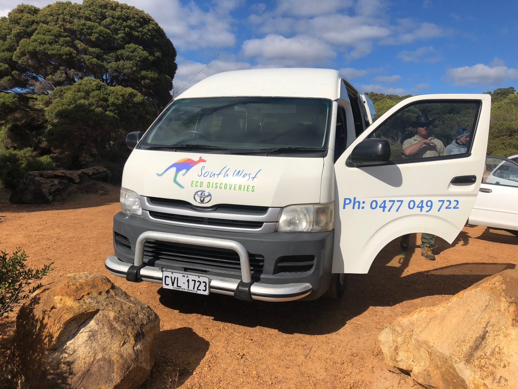
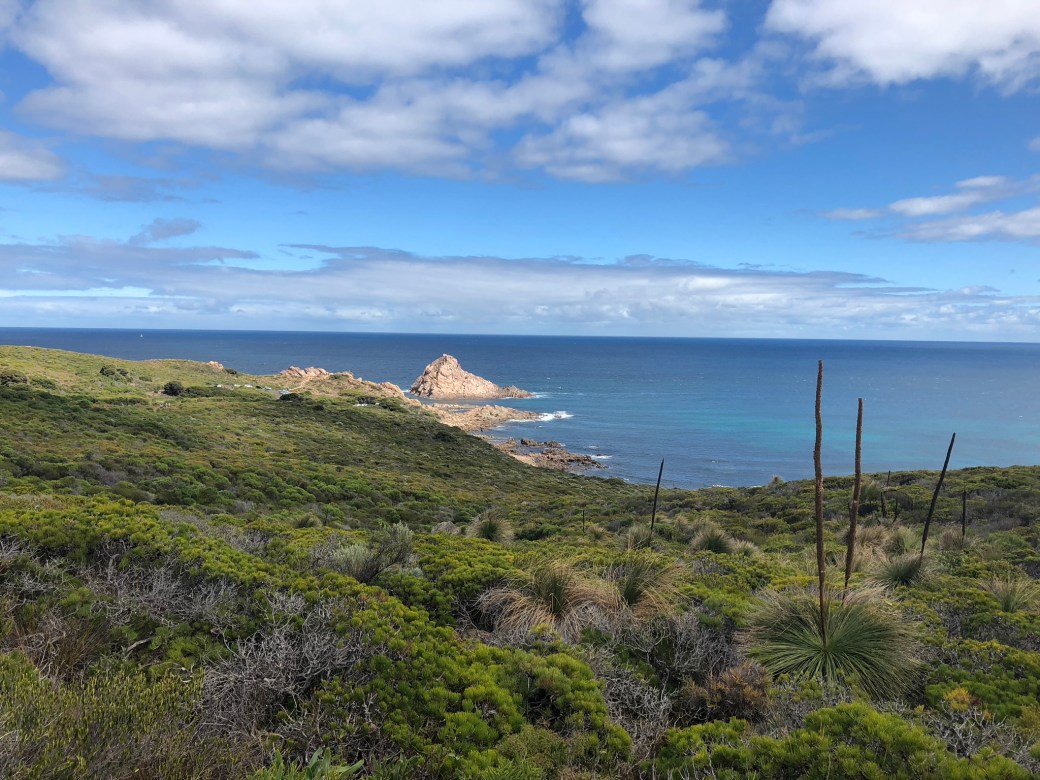
Cape Naturaliste: A Morning Tour with Southwest Eco Discoveries
From our home base in Busselton, we wanted to explore further (and without our own car). Therefore, we booked three tours. The first tour was a half-day morning tour of nearby Cape Naturaliste with a company called Southwest Eco Discoveries.
This relatively new company consists of two brothers who have lived in the area their entire lives. We were fortunate on this day to have the benefit of a private tour. We were treated to a wide variety of sites on Cape Naturaliste and a wealth of information from our guides who were extremely knowledgeable. We would recommend this tour to anyone visiting the area!


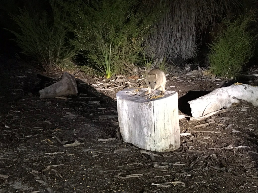
Visiting the Woylies (aka “brush-tailed bettongs”): A Nighttime Tour with Southwest Eco Discoveries
The same two brothers of Southwest Eco Discoveries also took us on a nighttime tour to observe woylies, a type of small marsupial, in a wildlife sanctuary near Busselton. “Woylie” is the traditional Aboriginal name for this animal. It is also known as the “brush-tailed bettong.”
Sadly, these small, nimble little creatures are extremely rare. Once common, the population of woylies in Australia has declined to between 10,000 and 20,000 individuals. The wildlife sanctuary where we viewed these woylies is private. Interestingly, this population started with a group of animals bred at the Perth Zoo.
Our tour began with a short bush walk to wooden benches. To keep the population viable within the sanctuary, the woylies are provided food—including by the brothers of Southwest Eco Discoveries. Soon after food was laid, the woylies arrived, along with another marsupial: a bandicoot!
In the darkness of night, we observed these nocturnal animals enjoying a healthy feast. We also were able to view a ringtailed possum in a tree.


And here is footage of a Western Ringtail possum having a snack (video courtesy of Syd). This is a threatened species with a limited range.
Not only did we have the privilege of observing threatened and critically endangered nocturnal species of animals, but we also enjoyed the light of a nearly full moon:

The Southwest Corner of Australia: A Tour with Margaret River Exposed
We were fortunate once again to have a private tour on our last day in the Margaret River region—this time with a tour company called Margaret River Exposed. Hank, our tour guide, is another person with a wealth of knowledge about Margaret River and the surrounding area due to his lifelong ties to the area.
One of first stops on this fabulous day was at Surfers Point in Prevally outside the town of Margaret River. We happened to be here just as preparations were being made for the Margaret River Pro, part of the World Surf League (WSL) World Championship Tour.
AND we happend to stop here when the surf was excellent and participants were getting in some practice days before the actual event. The video below shows an expert surfer catching a wave!
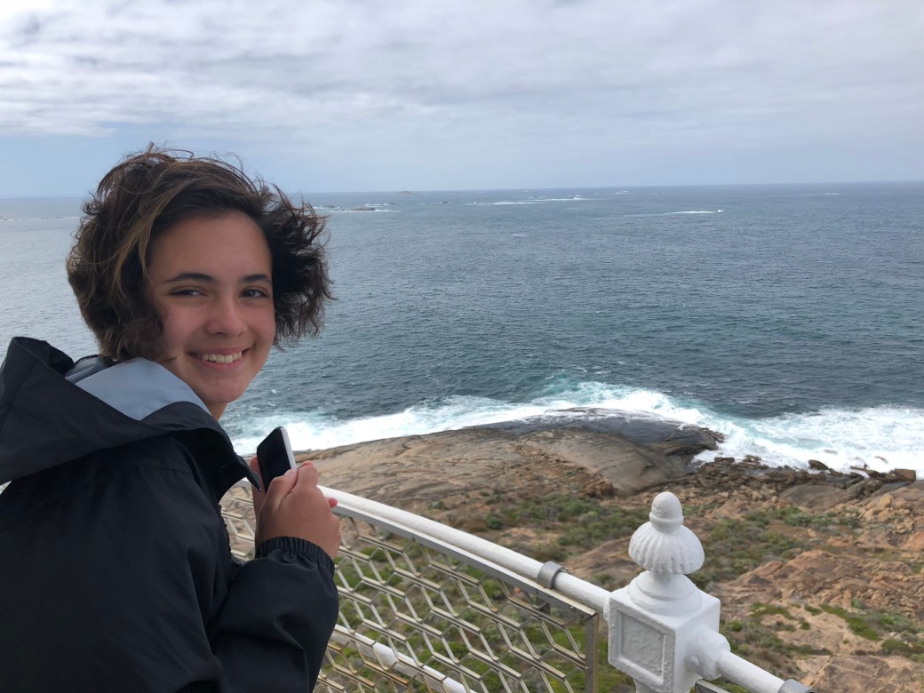
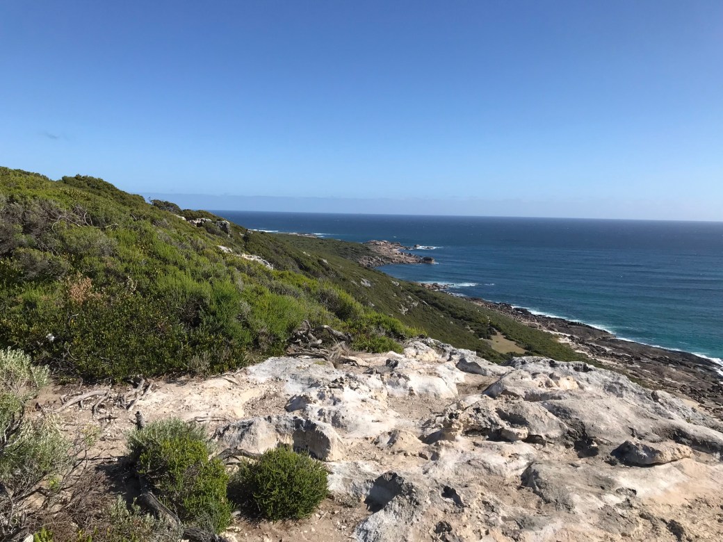
After observing the surf, we headed to Cape Leeuwin—famous for its lighthouse and its distinction of being at the point where the Southern Ocean and Indian Ocean meet.


Another morning stop brough us to Hamelin Bay, famous for its population of giant sting rays! The sting rays swim right up in shallow water at the beach to the delight of people waiting to pet them.
Here one comes . . .
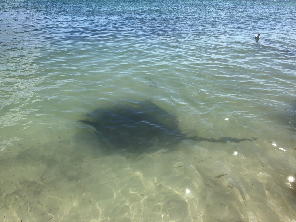
And here it is!
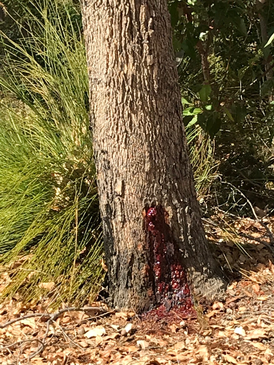
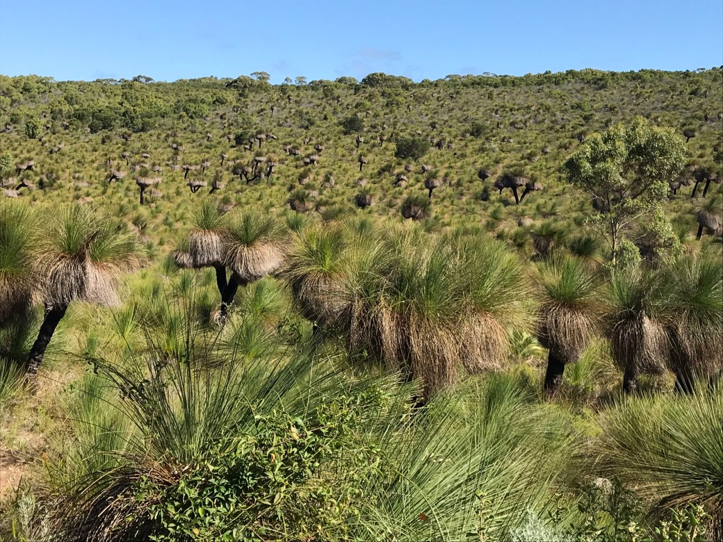
Our tour guide knew of Rich’s speciality in plants, so in the afternoon he took us to this point of interest. This is a low-lying area of grass trees . . . yucca-like plants with tufts of grass at the tops. These ones are perhaps 10–15 feet tall. Despite their seemingly delicate nature, it takes hundreds of years for a grass tree to reach this height, as they generally grow only about 2.5 centimeters per year.
This particular area was at the edge of a forest of tall marri trees. All four of us stood admiring the abrupt end to the forest and the expanse of grass trees and wondered—why did the forest suddenly end here with another species suddenly dominating the landscape?
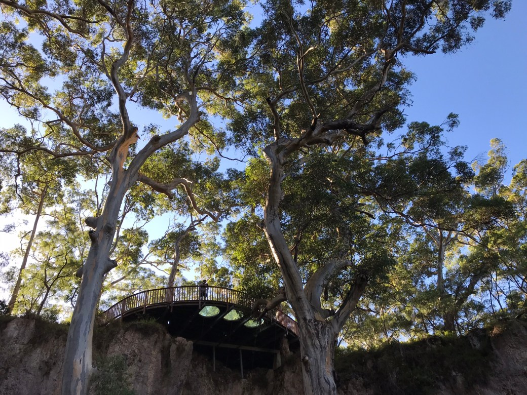
The next afternoon stop was Lake Cave. The Margaret River area contains a large area of karst topography; therefore, it is home to many limestone caves. Some of these, like Lake Cave, are open to the public.
Lake Cave is accessible by climbing many steps down to its entrance. This entrance formed many hundreds of years ago when the roof of a cavern collapsed. People know this due to the estimated age of the gigantic trees that are now growing in the entrance to the rest of the cave.


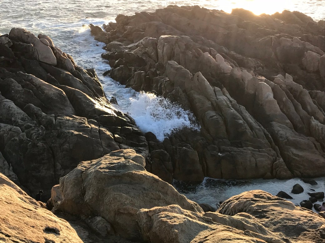
Our day ended with Hank taking us to a couple more seaside lookouts on the drive back to Busselton.

Right before sunset, we contemplated this area locally known as “the spa.” The rocks create a somewhat protected pool for wading, but waves still crash into the pool via a channel in the rocks, creating a “spa” effect for swimmers. It was a fitting end to a day witnessing the beauty, power, diversity, fragility, and unique nature of southwest Australia.

Well those are some simply gorgeous photos. What amazing trees!
LikeLiked by 1 person
Thanks! We feel very grateful for our time there. It is a special corner of the world.
LikeLike